Powerful Place. Schwarzbrunn in the Volder Valley
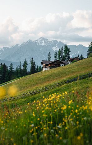
Schwarzbrunn in the far Voldertal valley is probably the least known of our power places in the Hall-Wattens region. At the same time, however, it is also one of the most beautiful and loneliest of them all. The journey here is spectacular in itself, as the Volder Valley offers breathtaking views down into the Inn Valley as well as numerous beautiful farms, Alpine pastures and the Volderwildbad, a former spa resort. There are countless stories and legends surrounding the Voldertal, such as "Das Pitzl mit dem alten Kopf", "Hilfreiche Mandln" or "Die Schimmelreiterin". The legend of the "Glungezerriesen" can be read in the lower section. It reveals the origin of the name of our place of power.
The Volderwildbad takes us back into history, when there was still a spa there. The doctor and polymath Dr. Hippolyt Guarinoni from Hall - who incidentally wrote the work "Grewel der Verwüstung menschlichen Geschlechts" and had the Karlskirche church built in Volders - is closely associated with the Volderwildbad.
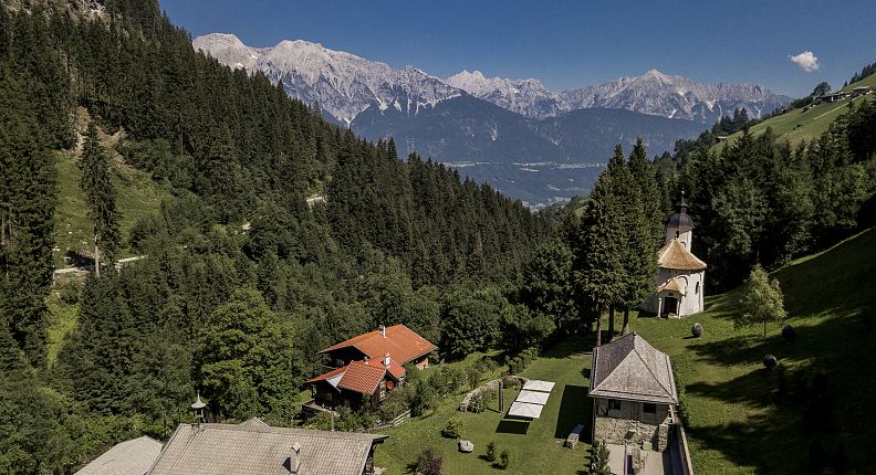
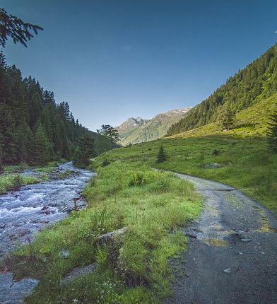
The Schwarzbrunn power village in the Volder Valley at a glance
- the mysterious Volderwildtal
- Intensive alpine pasture farming
- Mining in the rear Volder valley
- Exciting legends and stories
- Hippolyt Guarinoni and the Volderwildbad
How do you get to Schwarzbrunn in the Voldertal?
The hike to Schwarzbrunn
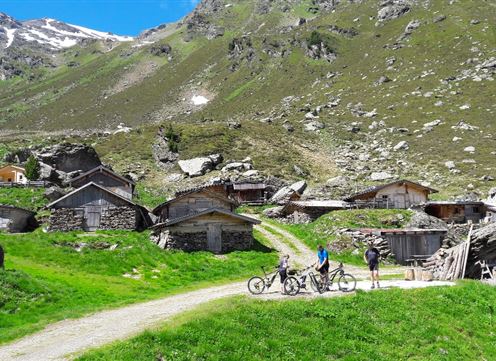
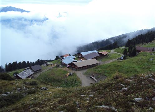
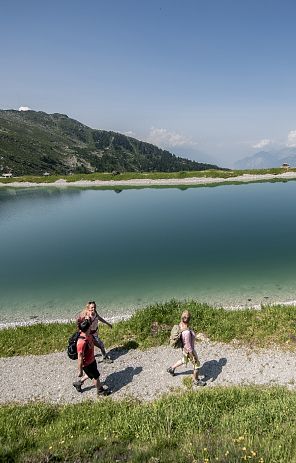
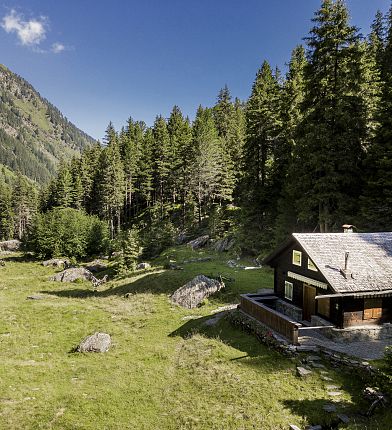
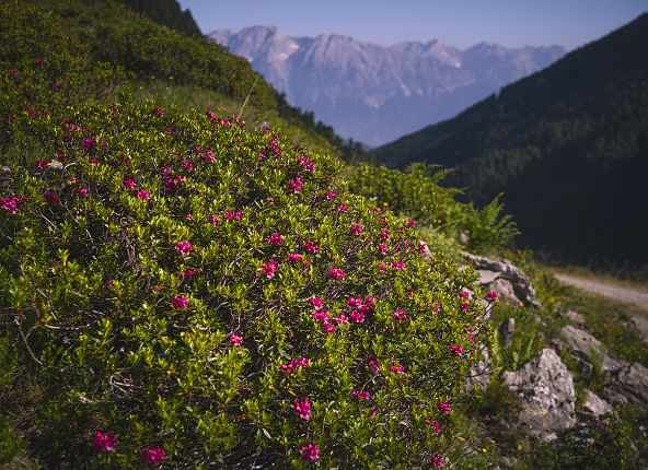
There are several ways to get to Schwarzbrunn. The most common is from Volders. By car, you can drive to the Volderwildbad parking lot (fee required). From here, you hike further and further into the green Voldertal valley along the wide road. At Nößlach, you will see the "Dörfl", a cluster of huts, on your right. The trail now continues slightly away from the Voldertalbach stream, with the end of the valley already in sight, up to an altitude of around 1650 meters. When you reach a clearing, the path bends to the left. If you look to the right, you will immediately see a solitary tree with a sign saying "Schwarzbrunn". Here you turn right onto the path and walk almost flat across to Schwarzbrunn. Once there, you will come across a private hut. An idyllic, almost kitschy landscape opens up in front of it: the Voldertalbach stream is almost lovely here and repeatedly forms larger spurs where children can play wonderfully. A small wooden footbridge leads to the other side of the stream. The vegetation is marshy in places, as are the flowers in this area. Again and again we see large boulders and on the left a path leads further up to Steinkasern, a rustic alpine settlement at 2002 meters above sea level.
Another hiking option is via the Tulfer side, Halsmarter - Voldertalhütte and then continue as described above.
The history of Schwarzbrunn in the Volder Valley
In 1753, three members of the Innsbruck Academy of Scholars undertook a research trip to Schwarzbrunn. In addition to investigating the "Gesund- oder Schwarzbrunnenwasser im Volderbad", the actual aim of the research was to investigate the "Veilchensteins" (the red green algae Trentepohlia Jolithus), which had first become known in the Volder Valley, and watercress (Nasturtium officinale). According to scholars, the latter plant gives strange relief. The cress at Schwarzbrunn can be found from early spring until the harsh winter. It was collected, cut, put in water and then boiled for a while to develop its effects. Many positive properties are attributed to this ancient medicinal plant. It is said to be an aphrodisiac and is recommended in naturopathy to purify the liver, lungs and stomach. Incidentally, watercress is very rare in nature and only grows in places where there is very clean water. In addition, recent American studies have shown that the nutrients and their density in watercress are many times higher than in other vegetables.
As far as our place of power is concerned, the quality of the healing water was therefore characterized very early on by the flora growing there. After examining the violet stones excavated from the Schwarzbrunnen, the scholars left the springs to rest "in their value and worthlessness".
Although there is no infrastructure at Schwarzbrunn today apart from the private hut, this was the subject of lively debate in the past. After 1753, many other scholars repeatedly referred to the healing waters at Schwarzbrunn in their dissertations and publications, which is why they wanted to build a bathhouse on this site. However, these plans were repeatedly thwarted by the Hall salt works, as the forests of the Voldertal were indispensable for the charcoal requirements of the salt and mint office in Hall. Others also objected to the construction of a bathing hut. These included the owner of the Volderwildbad at the time, the owners of the valley's mountain pastures, because the bathers would have had to drive through their mountain pastures, and the police, as they feared that during the uninhabited winter season, "wildlife-shy" and other riff-raff would stay there.
After the rejection of the fifth application, the efforts to build a wild bath at the Schwarzbrunnen, which had been documented since 1656, came to an end.
The huge rockslide of 1820 and other smaller ones characterize today's landscape at Schwarzbrunn with small lakes, a flattened stream and the large rock debris. Tradition has it that the spring almost completely dried up after the rockslide and that the underground course of the spring was partially relocated. This contributed significantly to the decline in interest in building at the Schwarzbrunnen, as the particular danger posed by subsequent rockfalls and landslides, avalanches and rockfalls was now obvious.
Where does the name Schwarzbrunn come from?
We have now heard a lot about why our power place Schwarzbrunn or the common spelling Schwarzbrunnen was of such great importance to the population in the past. But why the name Schwarzbrunn? There was a charcoal pile on the site of Schwarzbrunn, as these were always located near water to extinguish fires. As you can read in the section below under Voldertal, charcoal production was an important industry in the Voldertal. During inspections in 1951, it was discovered that the water jet of the Schwarzbrunnen does not flow directly from the ground, but from black charcoal pile earth. This is probably the reason for the name. The layer of charcoal also helped to filter and absorb the water, which was already low in minerals, so that - at least in the past - the water that flowed out was actually very low in minerals, pure and "mild". This type of water has a detoxifying effect on the human organism when used for long periods of time. One of the reasons for the constant efforts to build a spa at Schwarzbrunn.
The Volder Valley
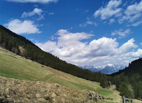
The Voldertal is a side valley of the Inntal and is spread over two municipal areas, namely that of Tulfes and that of Volders. It is obvious that the village of Volders gave the valley its name. On the eastern side, which belongs to the municipality of Volders, the slopes are rather gentle and gentle, while towards the Glungezer, i.e. the western side, they are mostly steep and rugged. This part is part of the municipality of Tulfes. The Voldertalbach stream flows through the valley and joins the Inn at Volders.
The Voldertal valley is home to numerous wild and romantic alpine pastures, as alpine farming plays the biggest role in this special valley alongside forestry. These include the Vorbergalm, Steinkasernalm, Markissalm, Largozalm and Stiftsalm. The Voldertal is surrounded by many well-known peaks, especially among locals, namely the Grünbergspitze, Malgrübler, Haneburger and the Largoz. The latter is a particularly beautiful panoramic mountain.
In the past, the Voldertal valley was closely linked to the Hall salt works and its forest estates. Around 1543, the forests of the rear Voldertal valley from Vorberg to Steinkasern were deforested by the Hall salt works for its own needs (boiling the brine) and for those of the mint and the glassworks in Hall in huge clear-cuts. Records of forest management in the Volder Valley date back to as early as 1483, but the first precise information about the forests of the Volder Valley can be found in the forest report of 1555. This forest report contained the following instructions: All the forest in the rear Volder Valley was to be driven to the Lände (= landing place near rivers). The term "drifting" refers to the floating of wood in streams. There was a landing place in the middle Voldertal, the large landing place by the Voldertalbach stream in the village of Volders. Two decades ago, Walter Grabherr located two Schwenzklausen in the area of the rear Voldertal valley. Schwenzklausen were wooden or stone barriers with gates at side streams. The so-called "Klaushöfe" were located in front of the hermitages, where the meltwater could accumulate. When the hermitage was full, the gate was opened. The water rushing out washed the wood down the valley. One of these "Schwenzklausen" was located before the ascent to Steinkasern at 1,860 meters, the other further down at the Schwarzbrunnen. These old timber pits were probably in operation most frequently in the 16th century.
In addition to wood drifting, charcoal production in the charcoal burning industry was an important source of income for local farmers in the Volder Valley from the mid-16th century. Until the 19th century, the metal processing companies and the salt works needed large quantities of charcoal for firing. Only gradually did hard coal and coke replace charcoal as an industrial and commercial source of energy. Charcoal burning was carried out by the farmers of the Volder Valley themselves, who supplied the charcoal at contractually agreed prices. Almost every charcoal farmer had his own charcoal kiln near his farm. There were also communal charcoal piles. The charcoal burning centers were located in various places in the Voldertal, one of them near Schwarzbrunn.
Around 1800, the demand for charcoal declined. With the Hall salt works, which had been using hard coal to heat the brewing pans since 1782, the Voldertal charcoal burners lost their main customer. Around 1895, the last charcoal piles in the Voldertal went up in smoke.
In addition to the timber drift and the coal companies, another economic sector was added to the Volder Valley, namely the mills. The area from the Volderwildbad down to the Au was the old "Mühlviertel". Until the first decades of our century, five farmers' mills stood there: Badmühle, Traxlmühle, Lumper- or Heißlmühle, Guggenbichler- or Hauswurzmühle and Auermühle. Most of these home mills stopped grinding 50 years ago and were later abandoned.
Volderwildbad
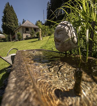
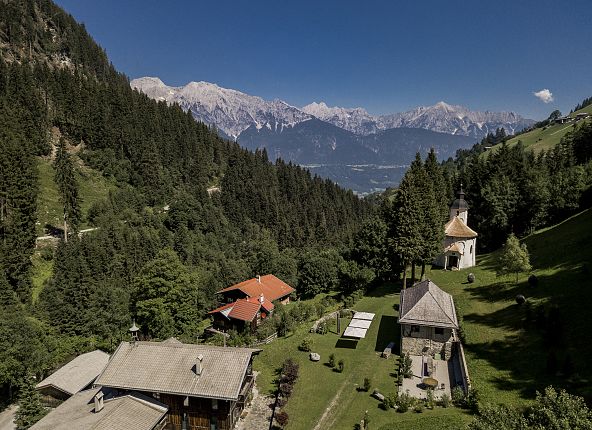
The Volderwildbad is an idyllic place and also very interesting from a historical point of view. The structure with the fantastic veranda is now privately owned and is used for events, especially weddings. The chapel is also located on the private estate, but is owned by the municipality of Volders.
About the origins of the Volderwildbad
"In the Volder Valley, a water springs up that contains sulphurous earth and is often helpful against rheumatism, chronic rashes, abdominal ailments and neuroses, to which the pleasant surroundings, the pure air and the quality of the facilities contribute." These words were used to advertise the Volderwildbad in the "Boten für Tirol und Vorarlberg" in 1830. A visit to the spa was recommended for all possible and impossible ailments for which "all doctors have despaired". The famous Haller Stiftsarzt physician Dr. Hippolytus Guarinoni had examined the spring and found iron, saltpetre, vitriol, sulphur and alum. A publication from 1756 states that the water in the Voldertal is a true fountain of youth. Other scholars from Innsbruck had also investigated the springs at Schwarzbrunn and Volderwildbad before Guarinoni and came to the same conclusions. The water was even able to heal war wounds, such as shotgun pellets pulled from the body. So it's no wonder that the Bauernbadl enjoyed a widely known reputation.
As early as the 15th century, in 1463, the baths in the Volder Valley were in use and very popular. Although Volderwildbad can be described as a typical "Bauernbadl", aristocracy and respected personalities from the upper middle classes also spent their spa stays there. These included the Habsburg Emperor Maximilian I.
The daily routine at the Voldertaler Bauernbadl was quite simple. The deceased former mayor of Großvolderberg, Josef Fink, had experienced spa trips to the Volderwildbad and recounted: "People went to the spa with sack and pack, bedding, kitchen and eating utensils. The healing water in the Swiss stone pine tubs was the main focus of the stay, which lasted several weeks. They bathed extensively, for hours on end, day after day. Some of the families catered for themselves in this state-approved healing spring. They cooked and roasted on several fires in the smoke kitchen in the Speckbacherhaus."
The baths remained open until 1968.
The buildings of the Volderwildbad include the former inn with veranda, Spritzenhaus, Fürstenhaus and the elongated bathhouse/priest's house. They form an interesting folkloristic ensemble dating from the 19th and early 20th centuries. The nearby church was donated and built by the barons of Gienger in 1625. The chapel was consecrated to Saints Cosmas and Damian in 1660. The building is similar to the Karlskirche in Volder and was designed by Hippolyt Guarinoni. In 1886, with the permission of the Bishop of Brixen, the Blessed Sacrament was solemnly placed on the newly erected altar.
The chapel was expertly restored by the municipality and the Monuments Office in 2019.
The alpine pastures in the Voldertal - then and now
Dilapidated structures and facilities from past alpine farming
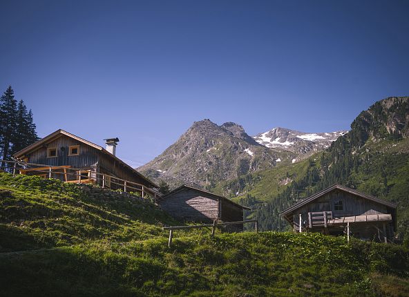
The fact that there are so many alpine pastures in the Voldertal has an important historical aspect. The high pasture areas and their buildings have always been an important part of our cultural landscape and were painstakingly built by the mountain farmers.
Although many alpine pastures and farm buildings can still be found in the Voldertal today, some have fallen into disrepair. Archaeologists call these "deserted sites" - visible remains of former buildings.
West of the Voldertalbach stream, in the municipality of Tulfes, there used to be a total of 31 buildings from pasture farming and mining in the area around the Stalsinsalm and Steinkasernalm alone. Above the Stalsinsalm at an altitude of just under 2,000 m, you can still clearly see the ruins of the mountain pasture, as the dry stone walls at the entrance area are still well preserved. There is also a rusty iron stove. There are also ruins of mountain pastures near the Gwannschafalm.
Some of the remains of the old stone walls have been gathered together. This was called "Almputzen". The reason for this is actually quite simple: grass does not grow where there are stones and this was and still is extremely valuable for the grazing animals.
Past buildings can also be seen around Steinkasern, in particular shepherds' shelters and pens for the animals as well as abandoned raised huts.
Active alpine farming in the Voldertal
- Stalsinsalm or also "Goasalm"
- Stiftalm
- Gwannschafalm
- Steinkasern

Mining in the Volder Valley
It is not only ruined mountain pastures that bear witness to past traces in the Voldertal. As the field name in the rear Voldertal suggests, mining was carried out at Eisenkar. Under the ridge of the two valleys, Voldertal and Wattental, there are layers of ore. This is evidenced by both written documents and traces of mining that are still clearly visible today, as well as dilapidated miners' structures.
The history of mining
Iron mining in the Voldertal was first mentioned in the 17th century. Documents from the Hall salt works prove this. Reports had to be submitted to the saltworks about the mining operations. We remember that until 1853, the saltworks managed large parts of the forests in the Voldertal and throughout Tyrol, as they urgently needed wood to fire the brewing pans.
Furthermore, ruined structures bear witness to the former mining history of the rear Volder Valley. To the south-east of the Steinkasernalm, there are some open tunnel mouths, dilapidated miners' huts, rock roofs and potholes for crushing the ore.
Literature: Burkhard Weishäupl, Hochalpine Wüstungen im Voldertal in den Tuxer Alpen
