We use cookies for your personalized browsing experience, to personalize content and ads, to provide social media features, and to analyze traffic to our website. We also share information about your use of our website with our social media, advertising and analytics partners. Our partners may combine this information with other data that you have provided to them or that they have collected as part of your use of the Services. (incl. US providers)

Medium

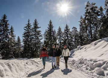
Varied hike along the Adolf Pichler Trail

Winter Hiking

11,80 km

03:00 h

374 hm

252 hm

955 m

Features & Properties

Stamina

Experience

Landscape

Map & Elevation Profile

Similar Tour Suggestions

Tobboganing in the Halltal

Medium

Sledding

4,71 km

01:30 h

543 hm

28 hm

1316 m

The Geier

Hard

Ski Touring

3,58 km

02:30 h

835 hm

2853 m

Schneeschuhwanderung zur Walderalm

Medium

Snowshoe walking

4,51 km

02:00 h

625 hm

12 hm

1502 m

Snowshoe- Hike from the Glungezer to the Patscherkofel

Hard

Snowshoe walking

5,20 km

03:30 h

197 hm

583 hm

2605 m

Skatingspur Gnadenwald

Easy

Cross-Country Skiing

6,43 km

01:58 h

181 hm

888 m

Tulfes-Rinn - Panorama-Loipe 2

Easy

Cross-Country Skiing

5,62 km

01:30 h

115 hm

921 m

Rodelbahn am Glungezer

Easy

Sledding

3,82 km

00:15 h

10 hm

510 hm

2057 m

PREMIUM Sonnenplateau-Runde Tulfes

Easy

Winter Hiking

8,44 km

02:30 h

202 hm

204 hm

1009 m