Hall-Wattens Tourismus
We use cookies for your personalized browsing experience, to personalize content and ads, to provide social media features, and to analyze traffic to our website. We also share information about your use of our website with our social media, advertising and analytics partners. Our partners may combine this information with other data that you have provided to them or that they have collected as part of your use of the Services. (incl. US providers)

Easy

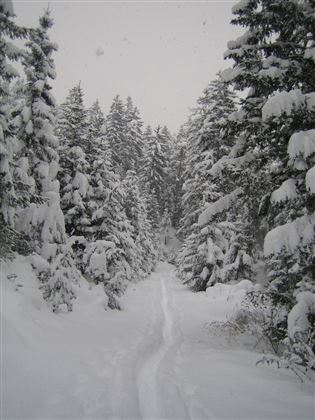
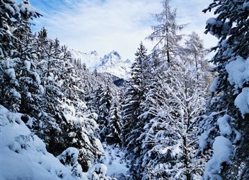
Tulfer Waldweg "Schöne Aussicht"

Snowshoe walking

3,44 km

01:20 h

108 hm

127 hm

1012 m

Best Time of Year

Jan

Feb

Mar

Apr

May

Jun

Jul

Aug

Sep

Oct

Nov

Dec

Features & Properties

Stamina

Experience

Landscape

Map & Elevation Profile

Similar Tour Suggestions

Varied hike along the Adolf Pichler Trail

Medium

Winter Hiking

11,80 km

03:00 h

374 hm

252 hm

955 m

Teufelsmühle - Winterwanderung

Medium

Winter Hiking

12,41 km

03:40 h

363 hm

1023 m

Loipe Gnadenwald

Easy

Cross-Country Skiing

15,74 km

02:00 h

267 hm

264 hm

877 m

Tulfes-Rinn - Panorama-Loipe 2

Easy

Cross-Country Skiing

5,62 km

01:30 h

115 hm

921 m

Skatingspur Gnadenwald

Easy

Cross-Country Skiing

6,43 km

01:58 h

181 hm

888 m

Tobboganing Kreuztaxen

Medium

Sledding

2,99 km

00:50 h

344 hm

1616 m

Besinnungsweg im Winter

Easy

Winter Hiking

3,50 km

01:00 h

123 hm

16 hm

906 m

Tobboganing in the Halltal

Medium

Sledding

4,71 km

01:30 h

543 hm

28 hm

1316 m