Hall-Wattens Tourismus
We use cookies for your personalized browsing experience, to personalize content and ads, to provide social media features, and to analyze traffic to our website. We also share information about your use of our website with our social media, advertising and analytics partners. Our partners may combine this information with other data that you have provided to them or that they have collected as part of your use of the Services. (incl. US providers)

Hard

Lippenkopf

Mountain Hike

5,54 km

03:00 h

627 hm

629 hm

1341 m

Best Time of Year

Jan

Feb

Mar

Apr

May

Jun

Jul

Aug

Sep

Oct

Nov

Dec

Information

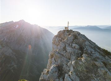
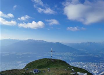
Over several rock steps, alternating with steep meadow slopes, we climb up until we reach the exposed lookout bench at the Lippenkopf. The view into the Garschaffl and the Inn valley is breathtaking for such an inconspicuous mountain!

Features & Properties

Stamina

Experience

Landscape

Map & Elevation Profile

Arrival

Thaur - Kapons hiking car park

Similar Tour Suggestions

Glungezer Via Ferrata

Medium

Via Ferrata

2,03 km

02:00 h

448 hm

2604 m

Wattental - Möstal - Lizumer Mountain Hut

Medium

Mountain Hike

19,72 km

06:30 h

1123 hm

1085 hm

2435 m

Naviser Jöchl

Medium

Mountain Hike

29,31 km

08:00 h

1710 hm

2478 m

Through the Halltal (valley) to the Halleranger

Medium

Mountain Hike

11,65 km

04:30 h

1344 hm

362 hm

2085 m

Kalkwand Umrundung

Hard

Mountain Hike

19,59 km

06:30 h

1194 hm

1802 hm

2516 m

Glungezer & Geier - High Altitude Trail

Hard

Mountain Hike

15,63 km

08:00 h

767 hm

1365 hm

2794 m

A hike around the Glungezer Summit

Medium

Mountain Hike

11,41 km

04:00 h

722 hm

704 hm

2668 m

The blue lakes

Medium

Mountain Hike

16,43 km

08:00 h

1507 hm

1512 hm

2637 m